Floaters

So do you call the people who “float” the river “floaters?”  Or “tubists.”  Or “tubers?”  Not sure I’d want to be referred to as a floater.  Gross.

“So did you go to the river?”

“Yeah, but it was really dirty”

“How do you know?”

“It was full of floaters”

Gross.

It’s late – what do you want from me?

DJI01794-Edit

Since I’m not allowed to launch inside a national park I had to hike down to the river edge from the road and launch from there. That’s Harpers Ferry in the distance on the left.

UAV

As it is with any government agency, the FAA has a “crap ton” of regulations and the hottest topic these days is UAV – Unmanned Aerial Vehicles.  There are huge numbers of differing opinions about their use and with them becoming much more accessible and affordable it’s gonna get really crazy really quickly very soon (already in some instances).  There are no-fly zone maps, advisory circulars from 1981, COA application procedures, and so on, and so on and so on.  It’s dizzying to say the least.  So here are some simple pieces of advise from me to other/future “droners:”

  1. Be respectful of anyone who approaches you about anything to do about your drone.  Whether it’s simply to find out more about what you’re doing and to watch or someone who’s got an issue with you flying it.  Doesn’t matter – be respectful in your conversations.  If it really gets heated just don’t fly there.
  2. Know your craft – EVERYTHING about it.  Not just how to get it up in the air, but what to do if you encounter an issue while it’s up there.  Know how to troubleshoot what’s going on from the batteries to the blinking lights to the regular maintenance.  Know its limitations and don’t push them just for the sake of pushing them.
  3. Be aware that there are regulations out there for UAV.  They may not be specifically  for this new category of aerial drone per se, but they are for UAV which technically includes your new DJI Phantom (or whatever you’re flying).
    1. Here’s a link to the current FAA set of regulations for UAV
    2. The National Park System has also issued its own policy on UAV within their parks.
  4. Know the regulations or at least be learning about the regulations.  I know there are pockets of rebellious “droners” out there who are going to put up the good fight for their rights, but the FAA’s ultimate goal for its airspace is the safety of everybody involved – in the air or on the ground.
  5. Use some good ol’ common sense folks.  Don’t be stupid about this.  We’re privileged to be part of a new group of enthusiasts that may very well affect the way the FAA leans when it comes to that 9/30/2015 deadline for integration of UAV in the NAS.  If we’re stupid about it now, guess what’s gonna happen when it comes time to develop new/updated regulations.
  6. Be safe.

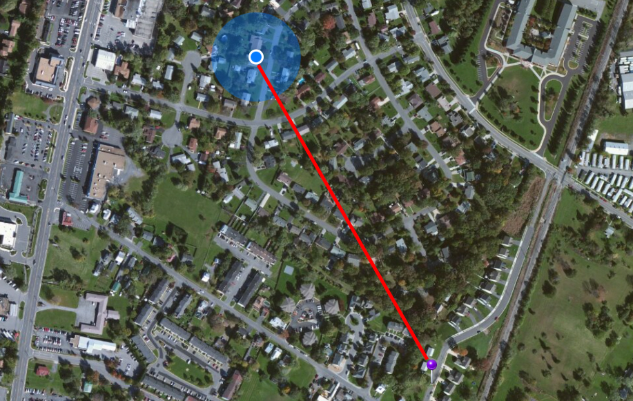
This post was initially going to be a rant about a confrontation I had with an individual this evening who wanted to make me aware of all the regulations that prompted his company to “ground” their drone and that I shouldn’t be flying if they can’t.  I was initially ticked off, but after careful thought, I decided to go this route to help promote awareness for common sense when it comes to this extremely touchy subject.  I began to realize that I’m just as guilty of not following these tidbits of advice at one point or another so I want to make sure that I ultimately keep myself in check, too.

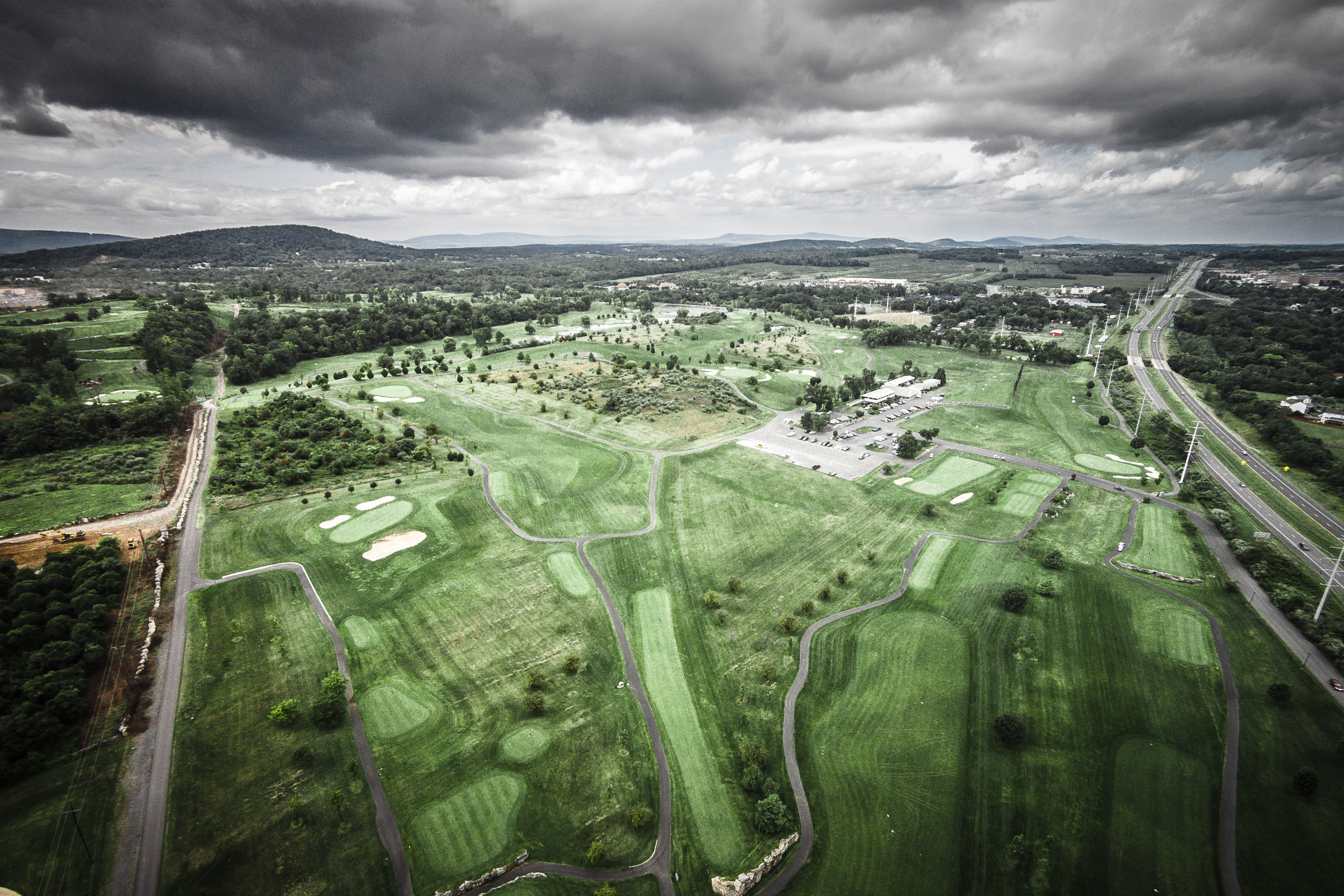
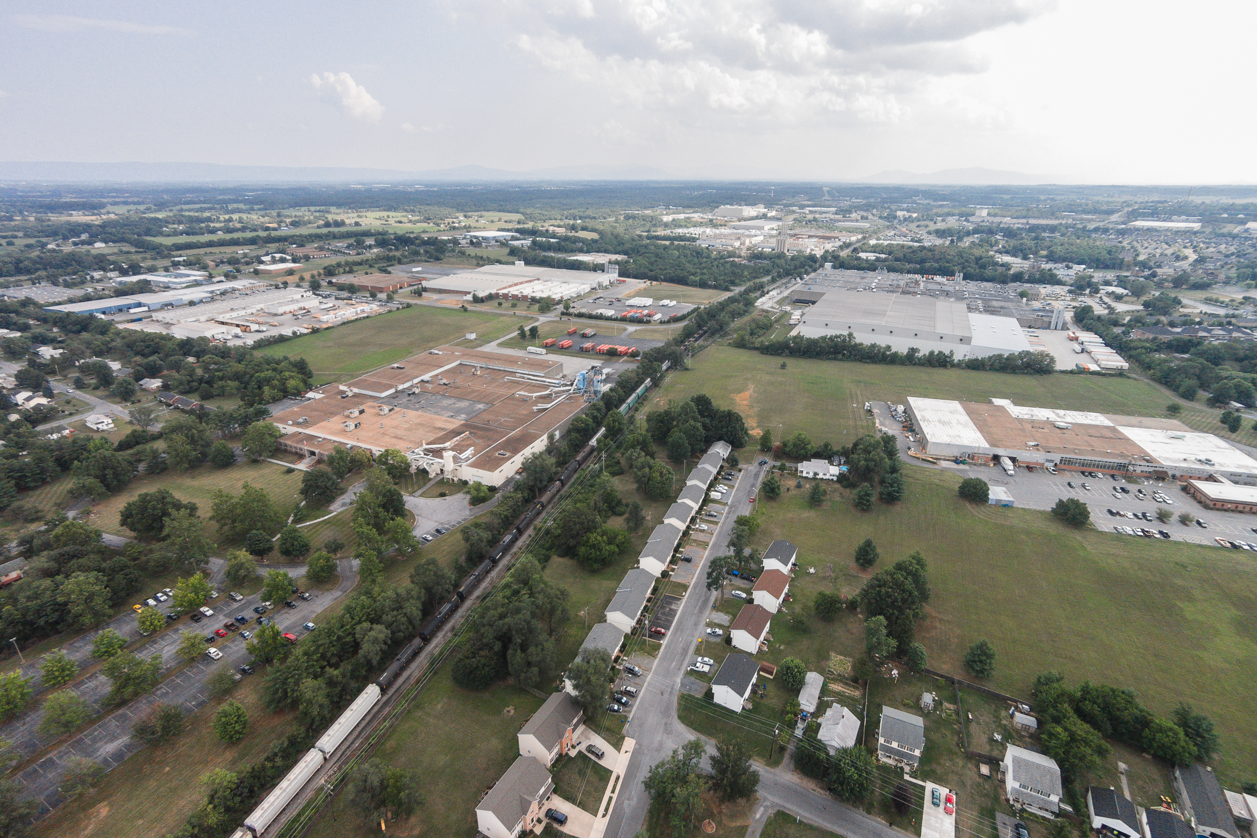
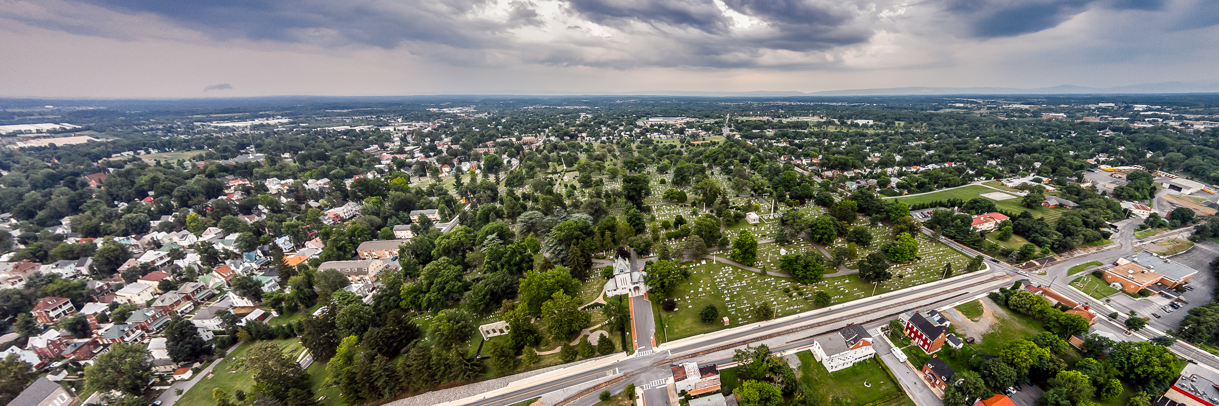
All I wanted to do was take some pictures of my elementary school…

DJI01836-Edit

My elementary school, which is no longer a public elementary school. This one’s for all those who attended Bridgewater Elementary School when it was located in “downtown” Bridgewater.

Golf

Aerial images of a golf course – no-brainer.

Rock Harbor Golf Course in Winchester, VA

Rock Harbor Golf Course in Winchester, VA

Turn Around

Every sunset and every sunrise is different to me, which is why shooting them will never get old.  But if you’re wondering “how can I shoot them differently?”  Simple answer…turn around.  You’d be amazed at what it sometimes looks like behind you.

I'm surprised none of the birds that were attacking the drone showed up in this image. | Check out my other sunset/sunrise images.

I’m surprised none of the birds that were attacking the drone showed up in this image. | Check out my other sunset/sunrise images.

DOG Street

I’m always concerned about what the reaction will be when I send my camera soaring into the air.  I was especially concerned while visiting WIlliamsburg this weekend.  I don’t know specifically why, but it just felt weird to me to be flying over Duke of Gloucester Street.  It just seems like such a proper place and I didn’t want to distract or disturb.  I ended up launching from the fields behind the Wren Building and flying to just over the Wren Building.  So, for all the Tribe alumni – enjoy.

Tasting

My wife an I went to a wine tasting yesterday.  We thought it was a very adult thing to do, why not?  We both got a little buzzed from just the tasting and neither one of us get it – the whole wine tasting thing.  Just what is a “silky finish” supposed to taste like?!  We wondered if you blindfolded someone and gave them the same wine in three glasses, but told them they were different if they would notice.

We have very similar tastes.  Apparently we really like the dessert wines so they might as well have served us plain grape juice.

These are just about to be harvested at the Williamsburg Winery

These are just about to be harvested at the Williamsburg Winery

Weekend Getaway

“A vacation is having nothing to do and all day to do it in.”

Robert Orben


Scenic View

Those scenic view overlooks along the highway take on a whole new look when you bring a drone to the party!

Mini Me

That’s me on my roof with my son.  Turns out there’s no difference in flight distance from my roof compared to the ground.  Might as well have launched from the driveway.  Oh well, it was fun anyway.

DJI01553-Edit

I can do your house, too – just contact me.

Campus

It’s sometimes difficult for some folks to make it back to their alma mater to visit.  Life has a way of getting in the way sometimes.  I graduated 21 years ago this year and JMU is such a different school (physically – I won’t get into the politics of all that’s been in the news lately).  I know I enjoyed my time there and hopefully this video will spark some memories if you’re also an alumnus.  Before I did the video of Handley I actually had this one started, but I didn’t have enough footage yet.  I’ve finally collected enough footage – enjoy.


Madison, James Madison
We’ll Be Forever True
Our Loyalty Will Always Be To JMU
While Friends Remain Within Our Hearts
And Knowledge Guides Our Way
James Madison Will Lead Us On
To Conquer Each New Day


Catching The Train

I’ve wanted to shoot aerial images of a train.  I just think it would be cool, but I just haven’t been in the right place at the right time so far.  Today I heard the train, but I was at home when I did.  I figured I’d try to catch it.  And I did.  The image isn’t that impressive, but in capturing this image, I was at the limits of both distances (altitude and distance from transmitter).  I have to fly it higher if I want to go further from me to maintain a solid signal between transmitter and receiver.  It’s more than a little unnerving when you’ve lost sight of the craft and you’re just about to lose visuals and geo-location in the monitor.  It doesn’t look very far on a map, but it’s a good 500-600 meters away from me.

Catching The Train

It’s pretty cool that the geo-location of the image includes the altitude – 389.2 feet by the way.

DJI01537


Model

I know that a lot of apps and cameras and software will emulate the Tilt & Shift effect these days – it became really popular really quickly.  I experimented with it, but never really got into it because it was hard to get the camera into the right position to accomplish one of the primary requirements of the effect – shoot from an overhead angle.  Well, I think I have that covered now.  This effect was done entirely in Lightroom, by the way.

DCIM100MEDIA

Handley High School in miniature.

Hard-To-Reach Spots

So now that the novelty of “how high does that thing go” has worn off, I’m concentrating on shooting unique images.  Images of scenes that people see every day, but they’re unique because I can’t normally get a camera into that position.  No crazy 900-foot high photos (although that still is fun) – mostly 150 feet or less.  Just enough to get over all the hustle and bustle at street level and it’s a totally different image.  Bet you can’t find me in this image (I am in it by the way).

Order a print of this image.

Order a print of this image.

Something’s Not Quite Right

One of my responsibilities at TV3 Winchester was to train the production staff and one of the first ways to demonstrate the “rule of thirds” was to show somebody a camera framing that was not quite right.  I would then indicate that maybe people at home couldn’t vocalize what was wrong, but they would know it.  Kinda like this image.  Something’s not quite right about it.  It looks normal at first, but as Mufasa from “The Lion King” would say “look harder…”

Order a print of this image.

Order a print of this image.

The Buzz

Are you tired of the aerial stuff?  I’m not and won’t be for a long while.  I think subconsciously I decided to shoot the race this weekend to make sure I still knew how to use my DSLR!  Along with so many things, another cool thing about the aerial viewpoint is that I can be in the images and not draw a lot of attention.  It’s kinda like “Where’s Waldo.”  Maybe I should make a cameo in the aerial images and make you try to find me.

I was shooting for a job today and, although I know this is very novel to many people right now, sometimes I just want to get my shots and move on.  I enjoyed talking to a lot of people today though about my work and this new perspective.  It’s quite the buzz around town – literally!

Can you see me now?

Can you see me now?  I started with an easy one.

Mobile Office

My office “window” for the day (that’s Shenandoah National Park in the distance).  Today was the first race I shot with the new camera and it was certainly a challenge.  At times I was shooting with three different cameras almost simultaneously.  It’s a crazy concept to shoot with the quadcopter.  When I needed to shoot with my wide on the ground, I would simply elevate the drone and let it hover until I was finished shooting – weird.  I really only shot video with it because I didn’t want to miss an actual still shot from the ground.  It was photog multi-tasking to the extreme.  And loads of fun!

By the way, race photos are being posted here.

Order a print of this image.

Order a print of this image.

Alma Mater

While my laptop is on the fritz (my GFX processor has all but blown up), it’s next to impossible to do anything creative while I’m traveling.  I shot some amazing images this evening at James Madison University (my alma mater), but am essentially “flying” blind in post.  I have absolutely no idea what this actually looks like (until, of course, I post it and look at it on one of my mobile devices.  So, here goes…

Alma Mater

Cemetery

I wasn’t initially going to post this one, but once it all came together I changed my mind.  I just like the perspective this one gives to the landscape.  By the way, this is the big cemetery in Winchester – Mt. Hebron Cemetery.  They advertise that they have space available for the next century!  Yeah, it’s huge.

Cemetery

Historic District

Every city has one.  Ours just got a major facelift over the past couple years and it’s really been revitalized.  Lots of stuff going on down there.  Only thing it’s missing is the view from up here.

Order a print of this image.

Order a print of this image.

Foreground

I like to shoot sunrises and sunsets.  I’ve said this before.  But after a while, as with anything, it gets harder and harder to shoot it differently.  Granted, each sunset and each sunrise is different, but how do I create something unique.  A big deal for a perfect composition is to have depth to your images and that’s done by introducing foreground elements.  That’s kinda tough when your camera is 250 feet up in the air.  I just wonder if I’ll get any backlash from this image because of how close I was to it.

DJI00720

By the way, if you live in the Winchester-Frederick County area of VA (and maybe even if you’ve driven through), you’ve seen this water tower along I-81 at exit 310.

DJI00717-Edit